
HG-J03 Lot 103 · Surveys
Ortho-graphy: city base layers from an aerial photo
Machine recognition on the authority's own aerial photo, manual completion and full QC: buildings, pavements, drainage, poles, signs, trees and more, with heights, in GIS, DWG and PDF.
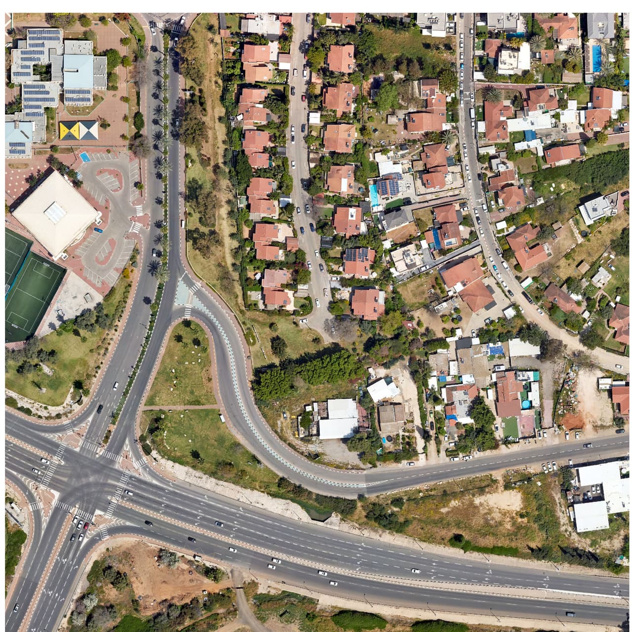
- Plan no.
- HG-J03
- Scale
- 1:1,250
- Sheet
- 03/16
- Updated
- 11.2026
- Client
- Local authorities
- Discipline
- Surveys
- Data source
- Client aerial photo · 3D model
Local authorities
Project provisions
-
Challenge
Base layers are usually built slowly: buildings in one project, pavements in another, trees perhaps a few years later. Meanwhile a recent aerial photo is already sitting with the authority, and what it shows does not yet exist as a layer anyone can filter, measure or maintain.
-
Solution
We ran machine recognition (AI) over the authority's existing aerial photo to flag features. Interpreters then completed by hand whatever the machine missed and checked every feature, with heights taken from the 3D model. Depending on the brief, the layers cover buildings, drainage inlets, manholes, culverts, fire hydrants, pavements and kerb colour, poles, signs, traffic lights, bus stops, bike lanes, roundabouts, parking, roads, traffic islands, lane lines, trees, shrubs and fences.
-
Outcome
The authority gets a full set of base layers for a whole area in a single project and works with it in its own system: counting, measuring, planning maintenance and using the layers as the starting point for future surveys.
Legend
Deliverables
| Key | No. | Deliverable |
|---|---|---|
| 103.1 | GIS layers from the aerial photo, to a layer list agreed with the authority | |
| 103.2 | Heights from the 3D model | |
| 103.3 | DWG and PDF files |
Plates
From the project
-
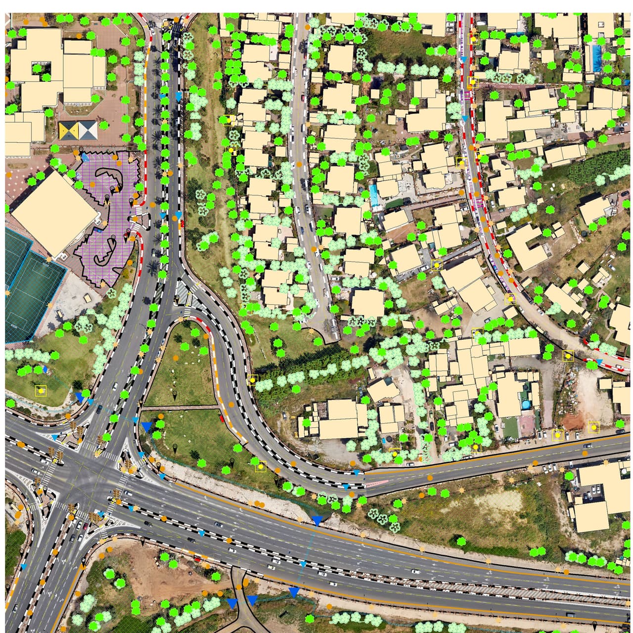
P-02 The same neighbourhood with digitised GIS layers: buildings, trees and road markings -
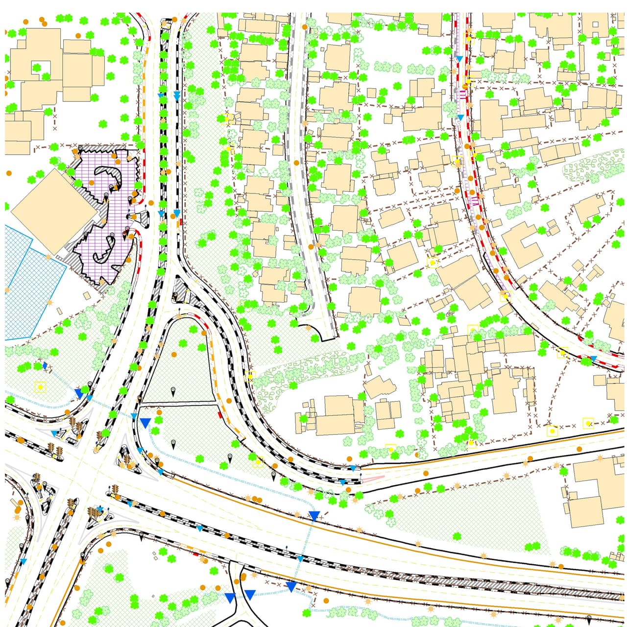
P-03 Layers only, without the photo: the data extracted from the aerial image -
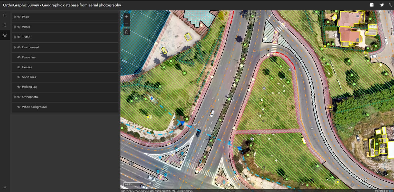
P-04 Dark map interface with a layer list over curved roads and green areas -
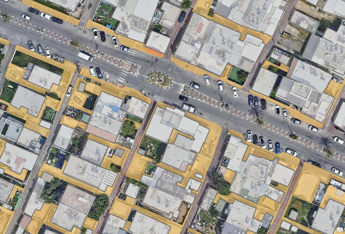
P-05 Buildings and pavements mapped over the orthophoto of a coastal city -
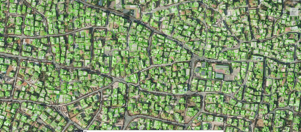
P-06 Neighbourhood with green outlines of mapped buildings -
P-07 Aerial photo of a neighbourhood and junction, before digitising -
P-08 The same neighbourhood with digitised GIS layers: buildings, trees and road markings -
P-09 Aerial photo of a neighbourhood and junction, before digitising -
P-10 Layers only, without the photo: the data extracted from the aerial image -
P-11 Digitising from the aerial photo: crossings, pavements and vegetation become layers

J-04 · Your next project
What do you want to move forward in your organisation?
Tell us what needs solving and we will come back with a proposed approach: a survey, a system, software, or a combination.