
HG-H00Municipal GIS company in Israel
From the field, to the layer, to the decision.
We build GIS software for local government, run field surveys and orthophoto mapping, and support your teams from data collection to everyday use. One accountable partner, from the first point in the field to the decision at the desk.
In motion
Four things worth seeing in motion
Real screen recordings and deliverables from our software and projects.
From CAD drawing to a GIS layer you can trust
Turns AutoCAD plans and AS-MADE surveys into clean, validated GIS layers, with topology checks, a quality report and publishing to your ArcGIS Online. Two modules: MABAT and AS-MADE.
Explore CADabra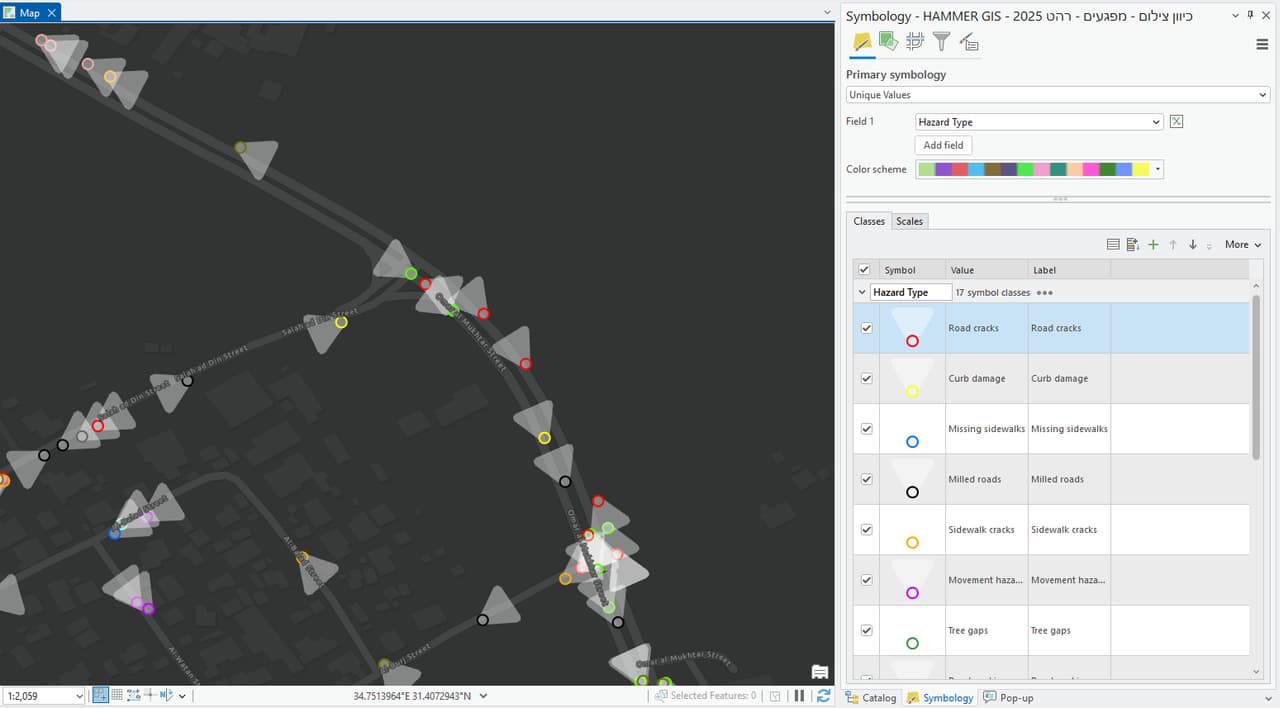
Field surveys that land straight in your system
A good survey doesn't end with a report. We collect on foot, by vehicle and from the air, check every feature, and deliver GIS layers ready to use, with location, condition and photo.
From orthophoto to GIS layer, with AI assistance and human review
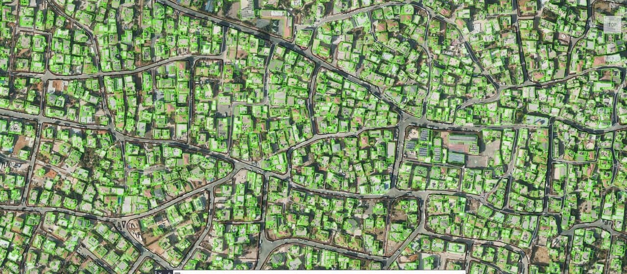
AI-assisted mapping from aerial imagery. NOW turns an orthophoto into vector layers that a GIS professional reviews and approves; WHEN finds when a place changed, using satellite archives.
Explore SEE.GMMA3D models
3D city scenes and building heights, for presenting plans and for shade and line-of-sight analysis.
From ground to data
Every good map starts in the field
An aerial photo is only the starting point. We break the city down into layers: what is there, exactly where, and in what condition. Every layer is checked, tagged with source and date, and loaded into a system people actually work in.
- Orthophoto A corrected aerial image where every pixel sits in its true position on the Israeli grid.
- Plots and parcels Plan boundaries, plots, blocks and parcels, so every record links to an address and a plan.
- Buildings Building footprints and heights, and how they changed over the years.
- Utilities Drainage, manholes, lighting and poles, with attributes and condition for each feature.
- Signs and markings Every traffic sign, pole and road marking, with its code, direction and photo.
- Trees and shade Trees, vegetation and shade: the groundwork for cooler, more comfortable streets.


Software
GIS software we built for the way municipalities work
Each product started with a problem we met in the field. Next to each one we say where it stands today, without rounding up.
-
 HAMMER CITY One map site for every municipal department: all your layers in one map, in your branding, on your own ArcGIS Online. Search by address, plan, block and parcel; print, measure and view CAD files on the map.
-
 CADabra Turns AutoCAD plans and AS-MADE surveys into clean, validated GIS layers, with topology checks, a quality report and publishing to your ArcGIS Online. Two modules: MABAT and AS-MADE.
-
 SIGNYX One system for the traffic-sign committee: requests, plans, map-based planning, meetings and decisions. The current ArcGIS-based version is in use at a local authority, and a new standalone web app is in development.
-
 CLIMYX Street-level analysis of urban heat islands and outdoor comfort, as a planning tool. CLIMYX builds on our heat-island mapping work for municipalities and is currently at proof-of-concept stage.
-
 SEE.GMMA AI-assisted mapping from aerial imagery. NOW turns an orthophoto into vector layers that a GIS professional reviews and approves; WHEN finds when a place changed, using satellite archives.
Surveys
Field surveys that land straight in your system
A good survey doesn't end with a report. We collect on foot, by vehicle and from the air, check every feature, and deliver GIS layers ready to use, with location, condition and photo.
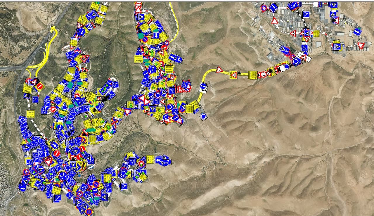
- Traffic-sign survey A vehicle-mounted camera drive with AI detection, then a human check of every image. Each sign gets its official code, address, direction and photo.
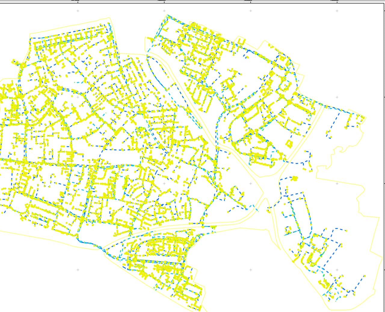
- Drainage and utilities Inlets, manholes and lines on the aerial photo, with attributes and condition, for maintenance and planning.
- Street lighting Every pole numbered and photographed: height, type, number of fixtures and the control cabinet it belongs to.
- Trees and green spaces Trees, vegetation and water meters in one layer, with a dashboard that shows the full picture.
- Public-space hazards and accessibility Damaged sidewalks, obstacles and accessibility barriers, mapped and documented so repairs can be prioritised.
- Building change detection Aerial photos from different years compared side by side, with findings flagged for building inspectors.
- Heat islands and shade Surface materials, shade through the day and tree canopy, with a priority map that shows where to shade first.
- Layers from aerial photos Ortho-graphy: AI detection plus manual completion of dozens of layers from an existing aerial photo, with full quality control.
Service & support
Support that doesn't stop at installation
A GIS succeeds when people actually use it. So our support runs like a survey traverse: station after station, and each one is closed before we move on.
-
ST-01
Consulting and scoping
We learn the data, systems and processes you already have, and agree together on what needs to happen and what success looks like.
-
ST-02
Setup and implementation
We set up the system on your infrastructure, connect your existing layers and fill in what is missing.
-
ST-03
Training
Role-based training, from occasional viewers to layer editors, with a user guide in Hebrew.
-
ST-04
Ongoing support
Answers in Hebrew from the people who built the system, controlled version updates, and the option to roll back.
-
ST-05
Development and growth
When a new need comes up, we add a tool, a layer or a dedicated app, built on what already works.
Additional services
Everything around the data
Sometimes you need fresh imagery, a 3D model or a large map for the meeting-room wall. We do that too, with the same precision.
- Drone capture and mapping Focused, high-resolution aerial capture of a site, neighbourhood or project, as the basis for orthophotos and models.
- 3D models 3D city scenes and building heights, for presenting plans and for shade and line-of-sight analysis.
- Digitising and scanning Plans, building files and scanned maps turned into GIS layers you can search and analyse.
- Data conversion AutoCAD, Excel and files from many sources converted into one consistent format on the Israeli grid.
- Maps for print Wall maps, publication maps and meeting-room maps, with clear, readable cartography.
- Planning and MABAT Layers and plan sheets prepared to the national MABAT standard, and support for statutory planning, including in Judea and Samaria.
From the field
Projects from the field
Three examples of real work with municipalities. We name clients only with their permission.
-
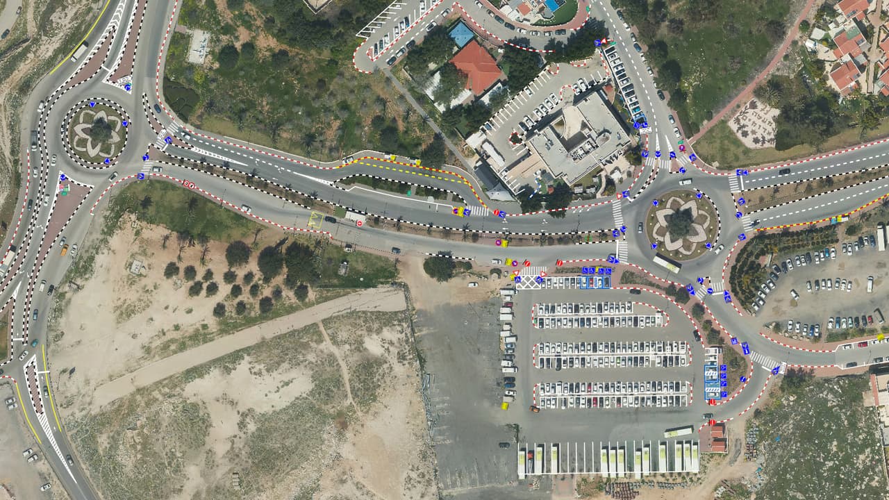
P-04 City-wide traffic-sign survey
A vehicle camera drive of the city's streets, AI detection and a human check of every image. The municipality received sign, pole and road-marking layers, all street images and a transport app on ArcGIS Online.
-
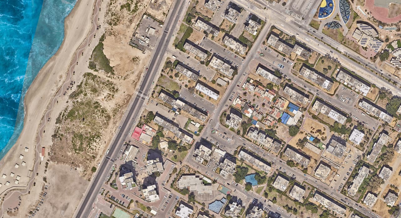
P-05 Street-level heat-island map
Tree canopy, shade structures, surface materials and building heights mapped, with shade modelled every half hour through the day. The result: a priority map showing where shade will make the biggest difference.
-
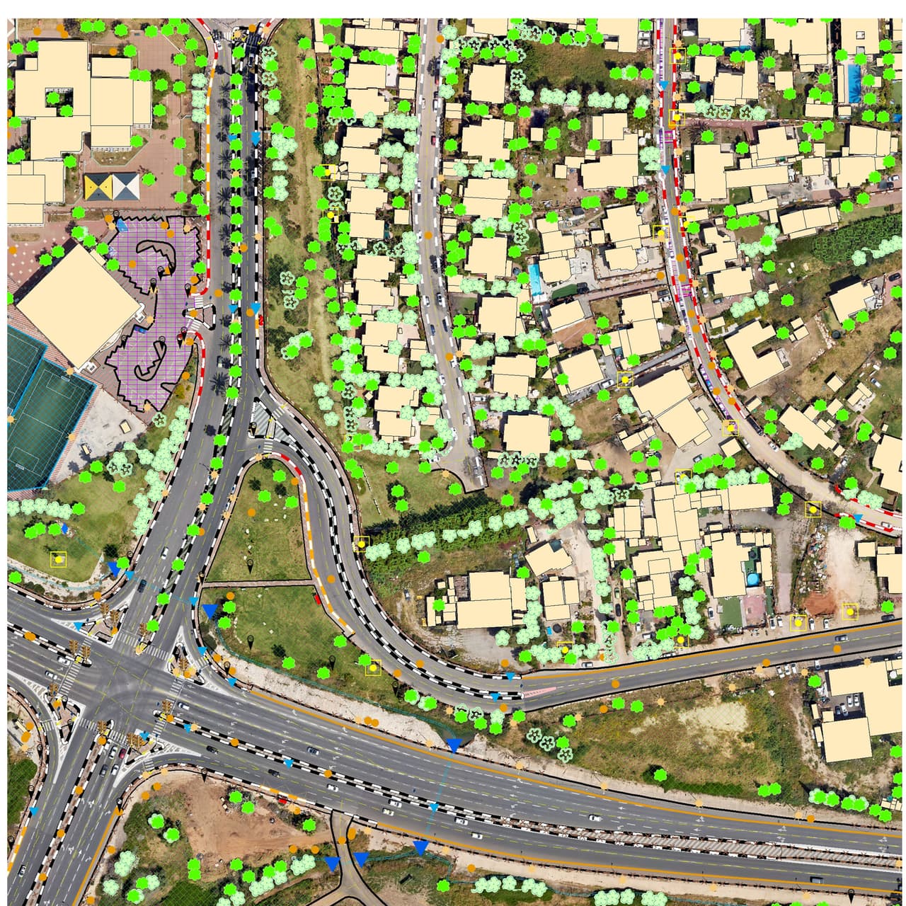
P-06 GIS layers from aerial photos
AI detection of dozens of feature types in an existing aerial photo, manual completion and full quality control. The authority gets GIS base layers without waiting for a full photogrammetric survey.
Why HAMMER
What you get when you work with us
- One partner, field to system The same team surveys, maps, converts and builds the software. No hand-offs between vendors, no data lost along the way.
- Real projects What we show was done in the field, for real authorities. Anything illustrative is labelled as such.
- See it before you decide A live demo of the software, and if you like, on a sample of your own data.
- Built for Israeli authorities The Israeli grid (ITM), the MABAT planning standard, the Survey of Israel mapping spec and Ministry of Transport sign codes. In Hebrew, right to left.
- Your data stays yours HAMMER CITY runs on your own ArcGIS Online, and survey deliverables come in open formats.
- Honest status for every product Live, pilot or concept: we say where each product stands, so you can plan with confidence.
FAQ
What municipalities ask us
What does HAMMER GIS do?
HAMMER GIS is an Israeli GIS company that works mainly with local authorities and public bodies. We build GIS software (HAMMER CITY, CADabra, SIGNYX, CLIMYX and SEE.GMMA), run field surveys and aerial-imagery mapping, and support teams through setup, training and day-to-day use. One partner, from the field to the system.
Do your products work with ArcGIS?
Yes. HAMMER CITY is built on ArcGIS and runs on your own ArcGIS Online organisation, with the sign-in and permissions you already have. CADabra publishes layers to your ArcGIS Online and exports a package that opens in ArcGIS Pro. We build on your existing investment rather than replace it.
How do we engage you: quote, tender or pilot?
Whatever process fits your authority and the scope: a price quote, a public tender or a focused pilot. We provide the documents your procurement file needs, and if you already have a specification, we're happy to review it with you before it goes out.
Can we start with a pilot?
Yes, and it is often the right first step. One neighbourhood, a main street or a single layer type is enough to see the result on your own data. You decide on the next step with something real in hand, not a slide deck.
Where is our data stored?
With HAMMER CITY your layers stay in your own ArcGIS Online organisation, and the app itself is hosted on Google Cloud in a separate environment per customer. CADabra is also hosted on Google Cloud. CAD files shown in HAMMER CITY are read in the browser only and are not stored on a server.
Who owns the data?
You do. The data you give us and the survey deliverables belong to your authority and are delivered in open formats. HAMMER CITY runs on your ArcGIS Online, so your layers stay in your organisation, independent of us.
What training and support do we get after go-live?
Role-based training, at your offices or online, and a full Hebrew user guide for HAMMER CITY. Support is in Hebrew, directly from the people who built the system. New versions are released in a controlled way, with rollback if needed. Support scope and response times are set in the agreement.
Are your systems accessible under Israeli Standard 5568?
We build to IS 5568 level AA, which is based on WCAG 2.1, and publish an accessibility statement for every system. HAMMER CITY offers full keyboard navigation, skip links, text resizing, high contrast and a way to stop animation. Its statement says openly what already conforms and what is still being worked on.
H-10
What do you want to move forward in your organisation?
Tell us in one sentence. We'll come back with good questions and, if it fits, a focused proposal.