
HG-J05 Lot 105 · Surveys
Building-change survey from two aerial photos
Every building coded on an older and a recent aerial photo; new, demolished and enlarged buildings flagged in a prioritised findings report for building inspection.
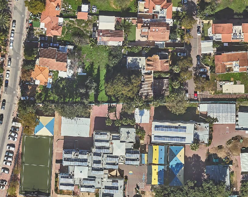
- Plan no.
- HG-J05
- Scale
- 1:1,250
- Sheet
- 05/16
- Updated
- 11.2026
- Client
- A local authority
- Discipline
- Surveys
- Data source
- Aerial photos 2020/2022 vs 2023 · oblique imagery
A local authority
Project provisions
-
Challenge
Building additions are hard to spot on patrol: they sit in back yards, on rooftops and behind facades. An inspection department needs a list of places worth checking, not another general patrol.
-
Solution
We coded every building on two aerial photos from different years and compared them. New buildings, demolished buildings and footprints that grew beyond a threshold agreed with the authority were marked in a change layer. Oblique imagery was used to check added floors, balconies and extensions that cannot be seen from above. Each suspected case got a screenshot, and the findings were compiled in a report by priority.
-
Outcome
The inspection department goes out with a sorted list and an image for every finding, and can cross-check it against permit records to focus on additions that were never approved.
Legend
Deliverables
| Key | No. | Deliverable |
|---|---|---|
| 105.1 | Change layer: new, demolished and enlarged buildings | |
| 105.2 | A screenshot for every suspected case | |
| 105.3 | Findings report by priority | |
| 105.4 | Optional cross-check with building permits |
Plates
From the project
-
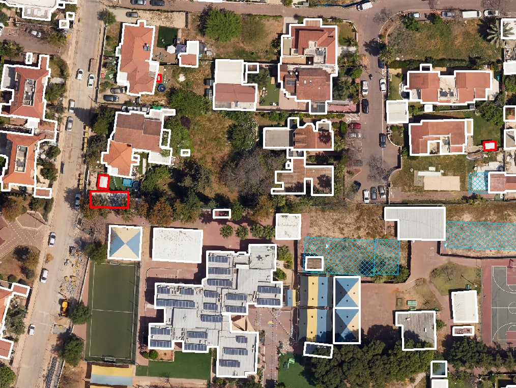
P-02 Later photo: new building footprints marked in red -
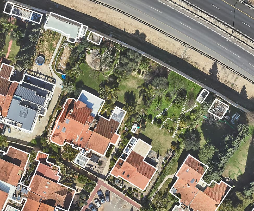
P-03 Earlier aerial photo of low-rise plots -
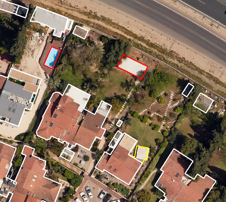
P-04 Later photo: building additions marked -
P-05 Earlier aerial photo of a low-rise neighbourhood -
P-06 Later photo: new building footprints marked in red
J-04 · Your next project
What do you want to move forward in your organisation?
Tell us what needs solving and we will come back with a proposed approach: a survey, a system, software, or a combination.