
HG-V06 Asset survey and facilities
Know what the municipality owns, where it is, and its condition.
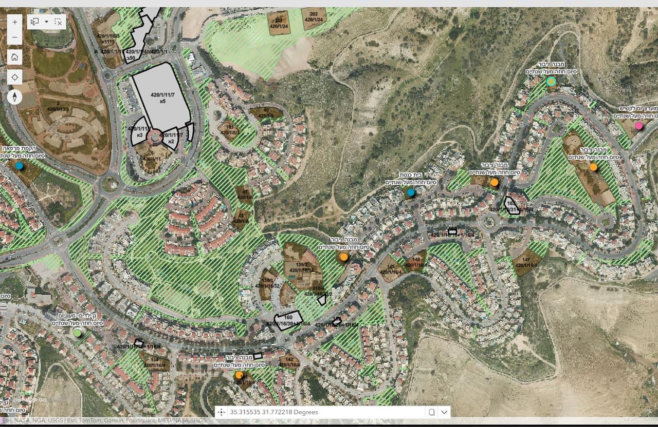
An asset survey maps a municipality's public assets and facilities: public buildings and plots, playgrounds, street furniture, bins, solar installations and cemeteries. The data is linked to leases and allocations and kept current with a field update form.
- Plan no.
- HG-V06
- Scale
- 1:1,250
- Sheet
- 06/06
- Updated
- 11.2026
What it is
From scattered lists to one inventory on the map
An asset survey maps and records the assets and facilities a municipality owns or maintains, with location, attributes, photo and condition, and links them to administrative data: leases, allocations and maintenance responsibility.
Information about municipal assets usually lives in several places: an Excel sheet in the property department, contracts in a folder, and what operations staff know from the field. A survey brings it together, checks it on the ground and leaves one inventory that each department sees from its own angle.
What we map
Assets, facilities and furniture
- Public buildings and plots Buildings and plots owned by the municipality, with leases, allocations and the responsible party.
- Playgrounds and sports Playgrounds, sports grounds and equipment, with location, type, photo and condition.
- Street furniture Benches, shade structures, litter bins and other items you define.
- Bins and containers Location and attributes of bins and waste containers, as a basis for collection routes.
- Solar installations Solar systems on roofs and in public spaces.
- Cemeteries Mapping of sections and graves, and a deceased-locator app, including a 3D view.
How it works
From the spreadsheet, through the field, into the system
-
ST-01
Gather what exists
Asset lists, leases, allocations and plans. Every existing record gets an ID that follows it into the system.
-
ST-02
Initial mapping
What can be seen from the air, such as buildings, plots and playgrounds, is mapped from the orthophoto.
-
ST-03
Field survey
Surveyors with a digital form record each asset: photo, condition and attributes, plus an update status for every record.
-
ST-04
Cross-check and QA
Field findings are compared with lists and leases, and gaps are flagged: an asset with no lease, or a lease with no asset.
-
ST-05
Delivery
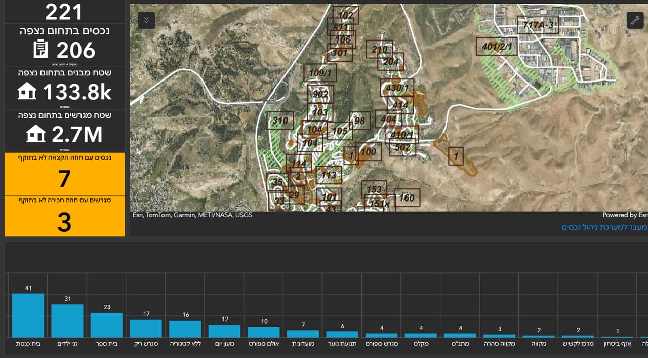
GIS layers, an asset-management app and a dashboard with totals by type, area and condition.
After the survey
An asset-management system, not just a layer
Survey results can be put to work in an asset-management app built on ArcGIS:
- Search and view Free search, layer view and a map showing each asset with its details.
- Edit on map and table Update details in the table, or drag an asset to its correct position on the map.
- Update status Every record has a status: not updated, details updated, location updated, or fully updated.
- Dashboard Totals by asset type, area and condition, for management and the property department.
FAQ
Questions about asset surveys
What does an asset survey include?
Mapping of the assets and facilities you define, such as public buildings, plots, playgrounds, street furniture and bins. Each asset gets a location, type, photo, condition and further attributes, plus a link to its lease or allocation where one exists.
How does the survey connect to our existing asset lists and leases?
We start from the lists. Each existing record gets an ID, and the field survey verifies it, positions it and fills in details. You end up with a gap list: assets found in the field with no record, and records with no matching asset.
Is there an asset-management system after the survey?
Yes. Results can go into an asset-management app built on ArcGIS, with search, map and table editing, an update status per record and a dashboard. If you use another system, we deliver the layers to it.
How is the inventory kept current?
Municipal staff update it themselves through a field form or the app, and each update gets a status. You can see at any time what has been updated and what is still waiting for a check.
Can you map a cemetery?
Yes. Sections and graves are mapped as GIS layers, and a deceased-locator app can run on top of them, including a 3D view, for office staff and visitors.
Can staff without GIS training use the system?
That is the goal. The forms and app are built for department staff, not GIS specialists, and we train each team on its own data.
V-06
Which asset is hardest for you to find?
Tell us which lists you already have and what is missing, and we will propose a survey that closes the gap between the spreadsheet and the field.